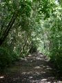
Cabrits headland is located between Prince Rupert Bay to the south and Douglas Bay to the north. Cabrits National Park is located on the headland and includes both terrestrial and marine nature. It is an interesting combination of historical garrison and fortification site and nature.
The most important historical site of Cabrits is Fort Shirley. The fort has been partially renovated in recent years. Next to the garrison, there is a cruise ship berth that – although not as popular as the one in Roseau – attracts particularly some smaller cruise ships.
Cabrits has got its name due to goats (cabras in Spanish) that were left there by sailors who used them as a source of fresh meat when visiting Prince Rupert Bay. Later the people have started to call the twin hills of the headland as 'West Cabrit' and 'East Cabrit'.


Next page: Lagon & Douglas Bay »
Photos taken by:
Initials are shown at the
page of each photograph.
See also:

Most of the photographs at this site are licensed under a Creative Commons
licence. See page of each image for further information.
